Gradjevno.com
Build Yes Or No
How we built an AI platform that answers in 30 seconds whether building is allowed on a plot — and gave hundreds of municipalities and cities a way to give citizens and investors clear answers without waiting at the counter.
Before the platform
- Answering the question "can you build here?" meant manually deciphering PPUO documents and spatial plans
- The architect charges ~€200 per plot, and the answer takes 3–7 days
- Land buyers risked buying a plot with no building potential
- Municipal counters were flooded with the same questions every day
- Data was buried in PDFs and zone maps without a simple interface
After the platform
- Enter the plot number — a yes/no verdict in 30 seconds, free
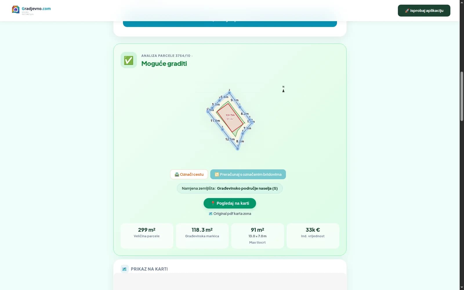
- The zone from the spatial plan mapped onto the plot boundaries with the building rules
- Every data point links to the source document (full transparency)
- KIG calculator and an indicative land value per zone
- A widget that municipalities embed on their own sites for free
Measurable results
Features we built
From entering the plot number to the AI report summary — every feature solves one step on the way to an answer.
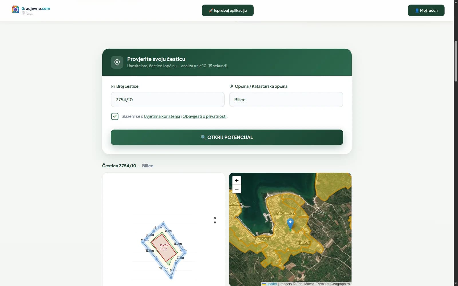
Search in 30 seconds
From plot number to answer, no waiting
The plot number and municipality are enough to start. No registration, no waiting — the verdict is on screen while you are still sitting down.
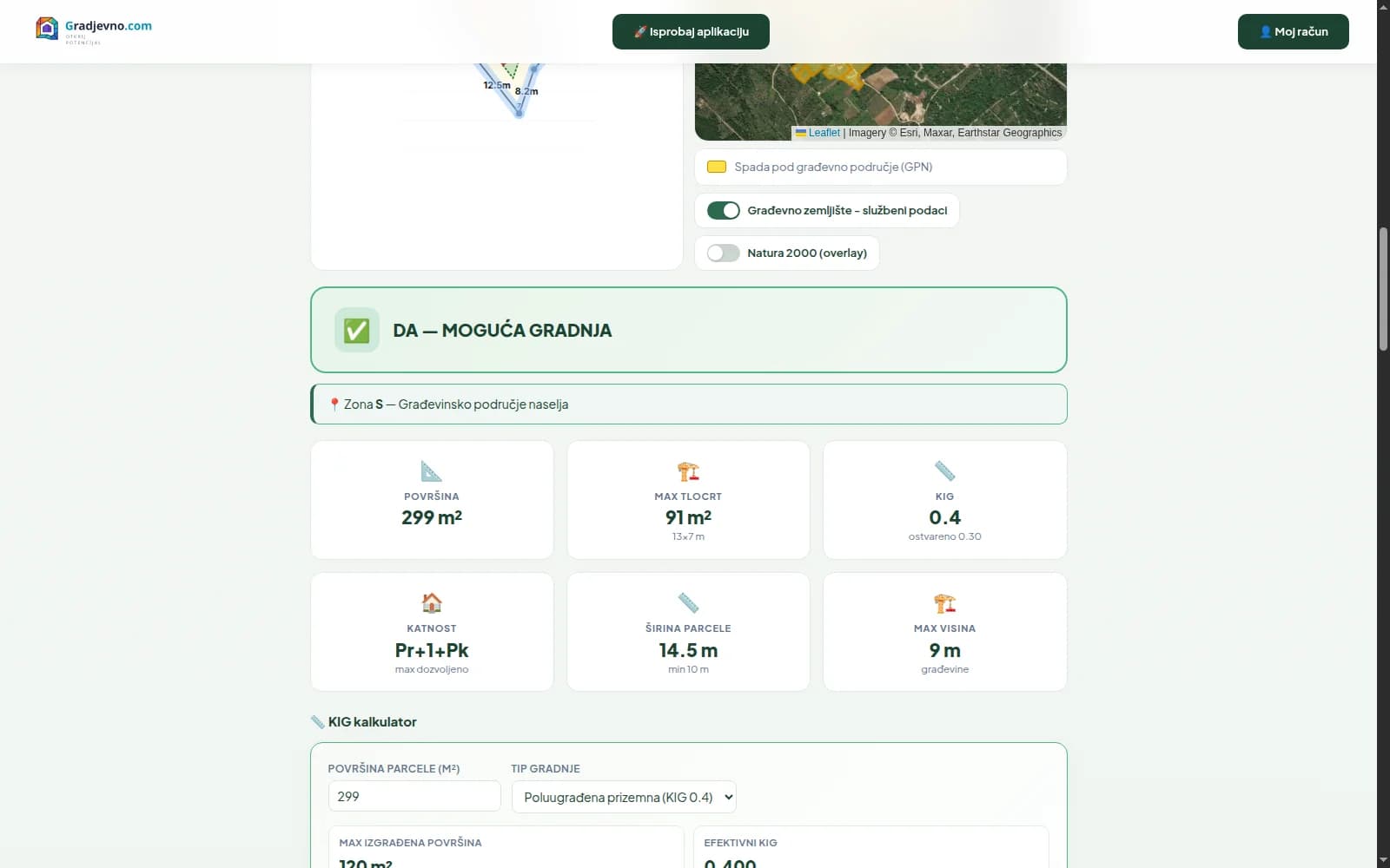
Yes/no building verdict
A clear answer to the key question
A clear answer without reading the plan. With the verdict you get the zone from the spatial plan and the reason why building is or is not allowed.
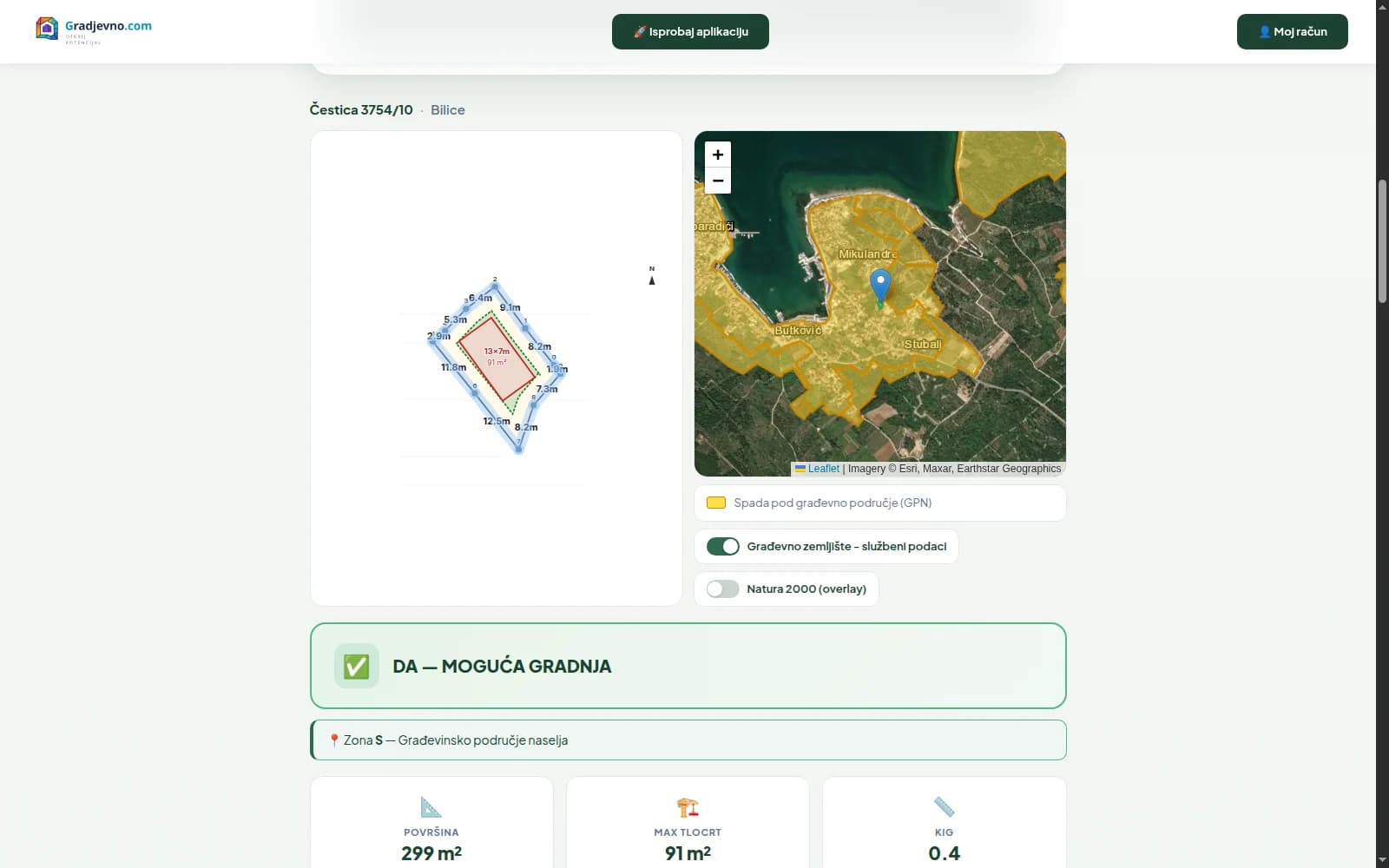
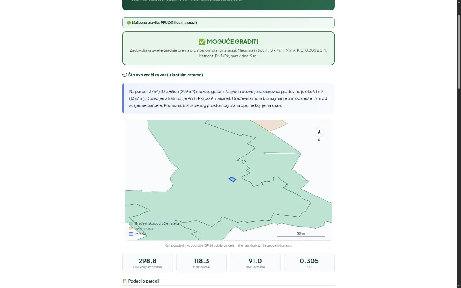
PPUO zones mapped onto the plot
The spatial plan as a live map
The spatial plan turned into a live map: the zone is recognised by the plot boundaries with GIS precision, including building-area layers and Natura 2000.
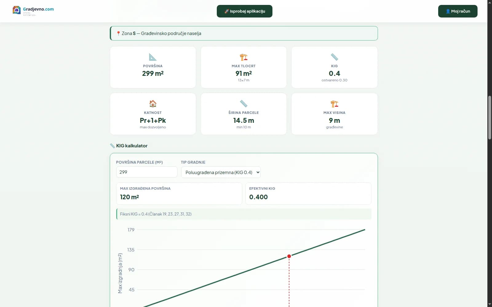
Building rules on one screen
Every number that decides what can be built
Plot area, building coefficient, maximum footprint, KIG, number of floors and height — the numbers that decide what and how much can be built, on one screen.
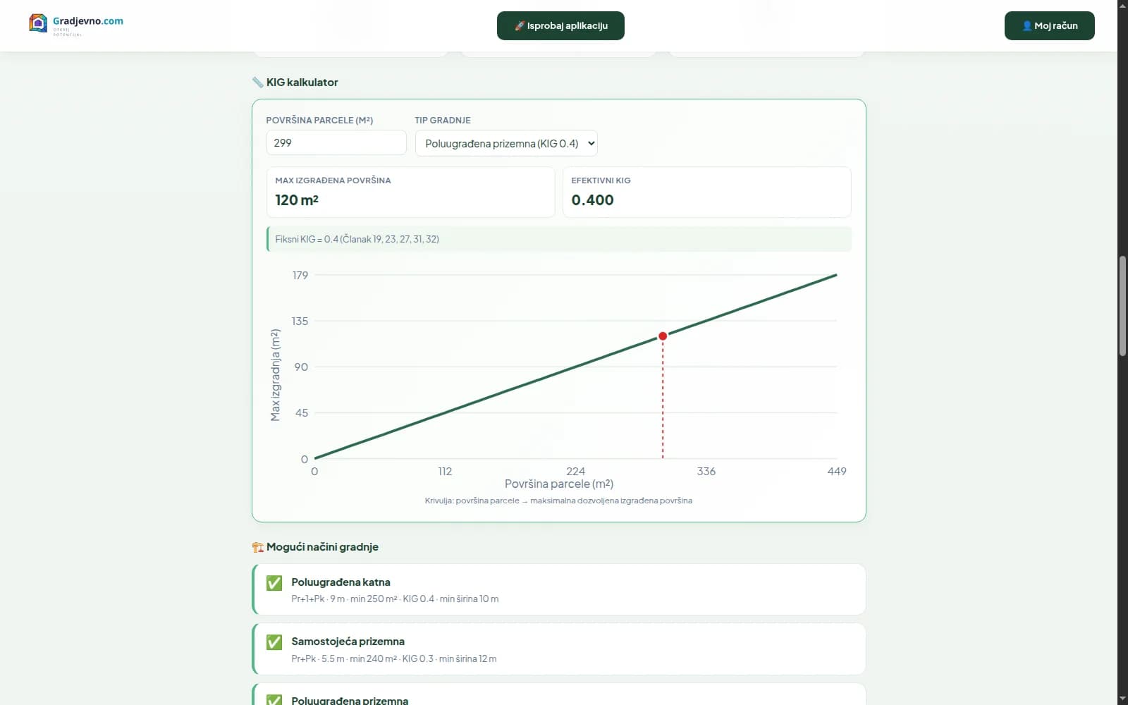
KIG calculator
Calculate the maximum build-out
Pick the type of construction and the calculator returns the maximum built area and the effective KIG — with a curve of plot area against the permitted build-out.
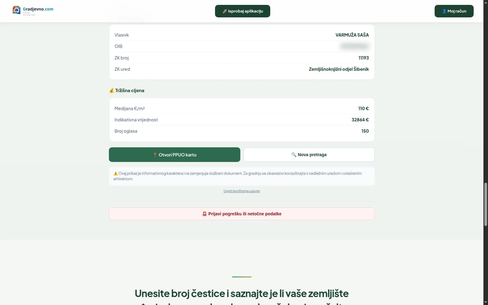
Land value estimate
Indicative price from listings
Median price per m², price range and an indicative value of the plot — calculated from real listings for that zone.
Full transparency
Every data point has a source
Every data point shown carries a link to the source document: DGU cadastre, PPUO article and page. Trust is not asked for — it is proven.
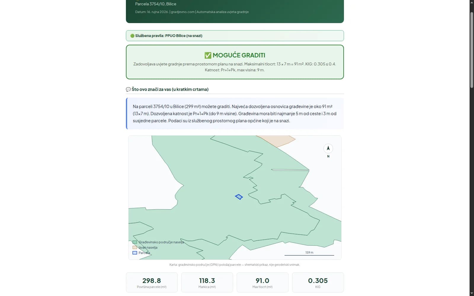
AI report summary
Findings in plain language
The report opens with an AI summary that translates the findings into plain language: what the coefficient, KIG and number of floors mean for your plot — without a spatial-plan dictionary.
Widget for municipalities
Checks on official sites
An embeddable widget that municipalities put on their official sites: citizens check their own plots, and the counters get some breathing room.
Under the hood
AI rule extraction from PPUO documents, geospatial analysis and production infrastructure — all in one system.
Want your own AI platform?
Gradjevno.com went from an idea to a production platform used every day by citizens, business owners and municipalities. If you have an idea with a clear problem behind it — we have the process that turns it into a product.